Three Falls was considered valuable and sacred for the Umpqua Takelma speaking tribe of Native Americans. There is a road named the Tiller Trail Hwy. Adjacent to the falls. At one point the road was even considered as the pathway for Interstate 5. In the end politicians in Grants Pass Oregon won out and the highway was diverted toward them. The prospect of the Tiller trail becoming a major four lane thoroughfare died. Nevertheless Tiller Trail Hwy is frequently used as a two lane rural road today. It’s ancient function as a reliable valuable path of travel from one side of the Cascade divide still stands.
Tiller Trail Wagon Road
Tiller Trail Road 1921
Tiller Trail Today
In the 1950’s the road was ungraded by widening and paving to make way for post WWII modernization. According to area elders it was at that time during dynamiting and bulldozing that three large boulders were pushed into Elk Creek at Three Falls.
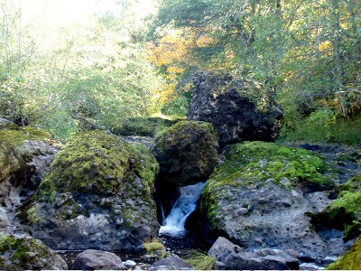
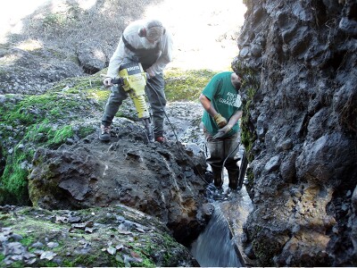
SURCP wanted to make a record of historical ecological conditions in the watershed. It did so by making video recorded interviews of individuals that lived in the area 50 years or more. There was a general consensus by the interviewees that the man made boulder barrier was a serious impediment to salmon and sea run trout migrations. SURCP Board members observed this happening during the Autumn salmon spawning season. Coho salmon were nose diving into the boulders. Unless there were extremely high water levels in the stream to open side channels the boulders were a formidable impediment. It didn’t take long do decide they had to be moved. The image galleries below record the boulders and debris removal. Select an image and navigate through a gallery.
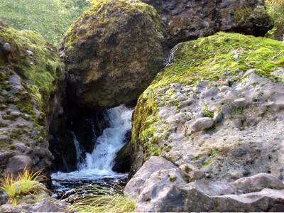
The Man Made BarriersAt Three Falls
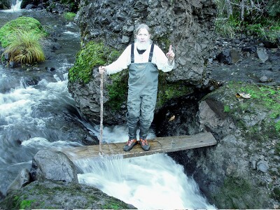
Salmon would dash against the lower boulder according to tribal elder Chuck Jackson
Two Upper Boulders
Large Main Barrier
Massive Upper Boulder
Lower Boulder
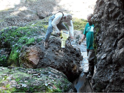
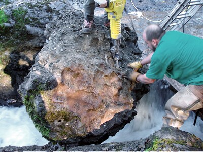
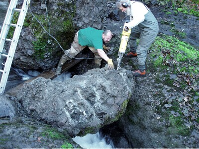
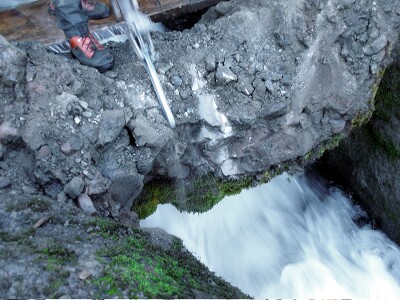
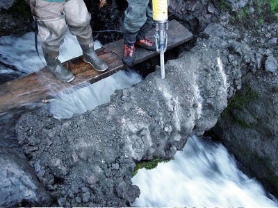
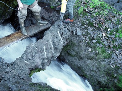
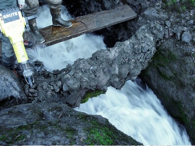
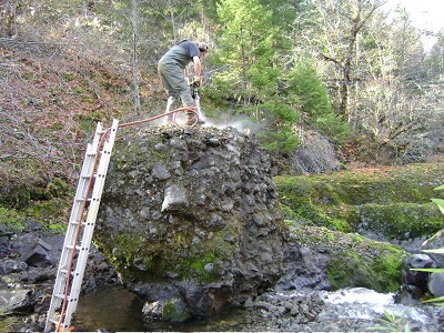
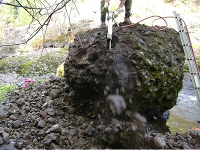
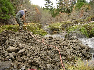
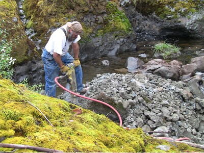
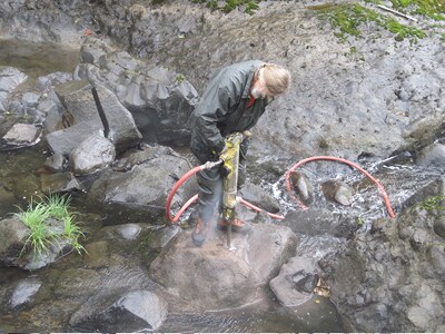
Middle Main Fish Barrier Local citizens get into action when it appeared dynamite permits were not possible. This main barrier boulder was about 7 feet in diameter. The following sequence illustrates the strength of the volcanic rock. Agglomerate rock is formed in volcanic breccias. It would most likely take many hundreds, if not a thousand plus years for this barrier to naturally erode. The ninety pound jack hammer had a difficult time of it.
90 lb. Jack Hammer
Volcanic Agglomerate
Harder Than Concrete
Road Rubble Blocked Fish
Two Men and a Full Day
Painstakingly Slow
Shocked! No Collapse?
Shocked! No Collapse?
Shocked! No Collapse?
Shocked! No Collapse?
Agglomerate Rock Exposed
Main Barrier Removed
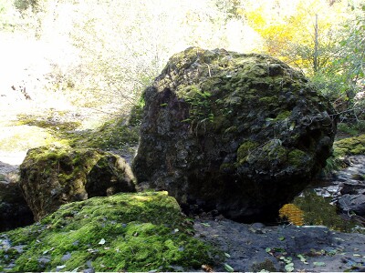
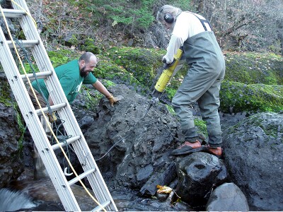
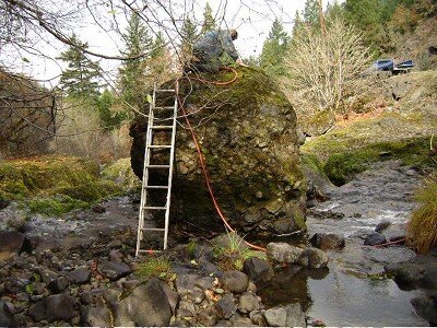
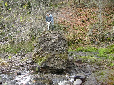
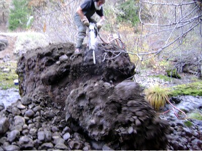
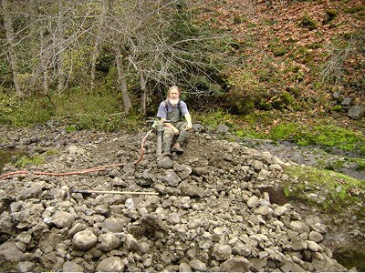
Massive Boulder This second boulder (approximately 11 feet tall) needed to be removed also. An earthquake would have made it a formidable barrier for salmon and see run Steelhead trout to surpass. We have conclusive evidence that Spring Chinook salmon also spawn in this watershed.
10 Feet Tall
Two Days Of Work
Progress
Chipping Away
Large Fracture
USFS Supervision
Gaining
Gone
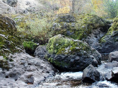
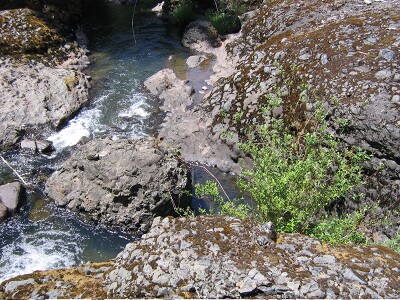
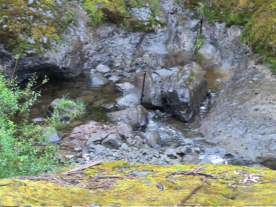
Lower Boulder This lower boulder was positioned directly in the path of the lower pool channel creating a water jet barrier for the fish to negotiate. It also presented a barrier to the natural scouring of the pool. Fish require some depth to gain momentum for jumping. Thee core drilled rock with the hole in it proves the rocks were blasted from the surrounding rock formation.
Lower Boulder
Board Member Leonard
Lower Agglomerate Boulder
Volcanic Agglomerate
Basalt Boulders
Basalt Boulders
Results
Core Hole From Road Blast
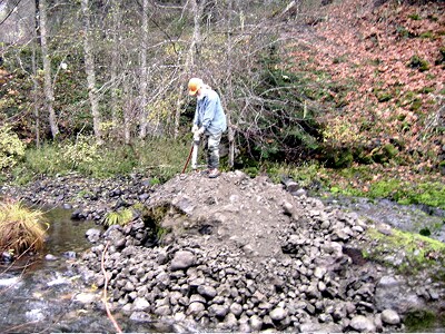
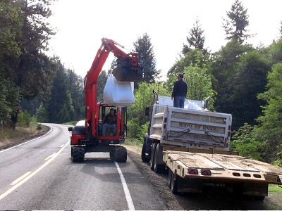
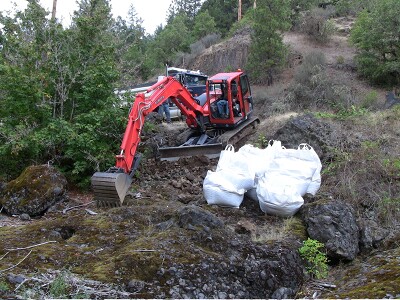
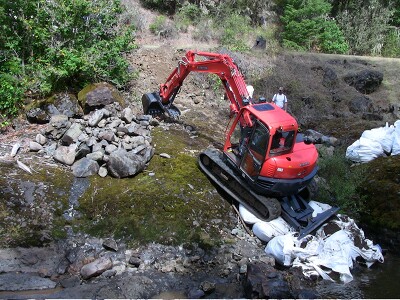
Clean Up Local equipment owner operator Matt Crume from Rocky Top ranch. This is the final phase of the project.
Rocky Top Ranch
Steep Incline
Debris Removal
Excavations
Staging Debris
Staging Debris
Finishing Up
Equipment Extraction
Job Well Done
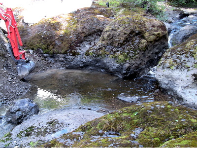
Ready for the Autumn salmon run
The picturesque results
With the assistance of community members, SURCP Board members and the local work force skill sets a difficult but worthy task was completed. An extensive reach of ideal habitat is once again more readily available for spawning anadromous fish species. The video below captured the best Coho salmon run at Three Falls since restoration work in the watershed began.